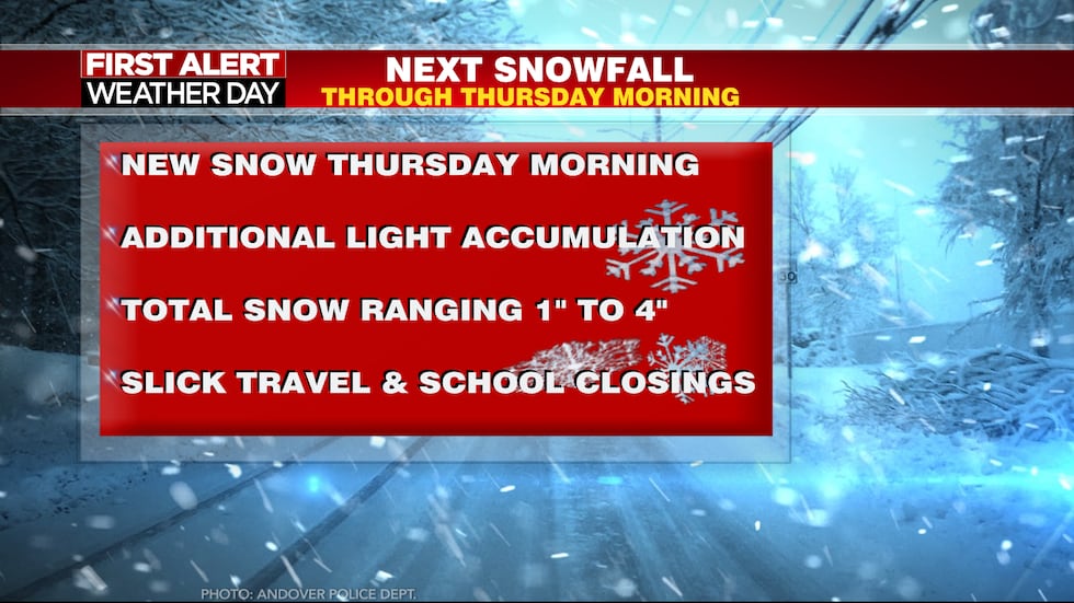
CHARLOTTESVILLE, Va. (WVIR) – Mostly light snow will continue through the mid-afternoon. A break in the steady snow by this evening and overnight. New snow will arrive Thursday morning!
First Alert Weather Day continues through Thursday morning. This is for additional light snowfall and slick conditions. Also, bitter cold temperatures for this time in February.
The steady snow will exit from west to east by later this afternoon and tonight.
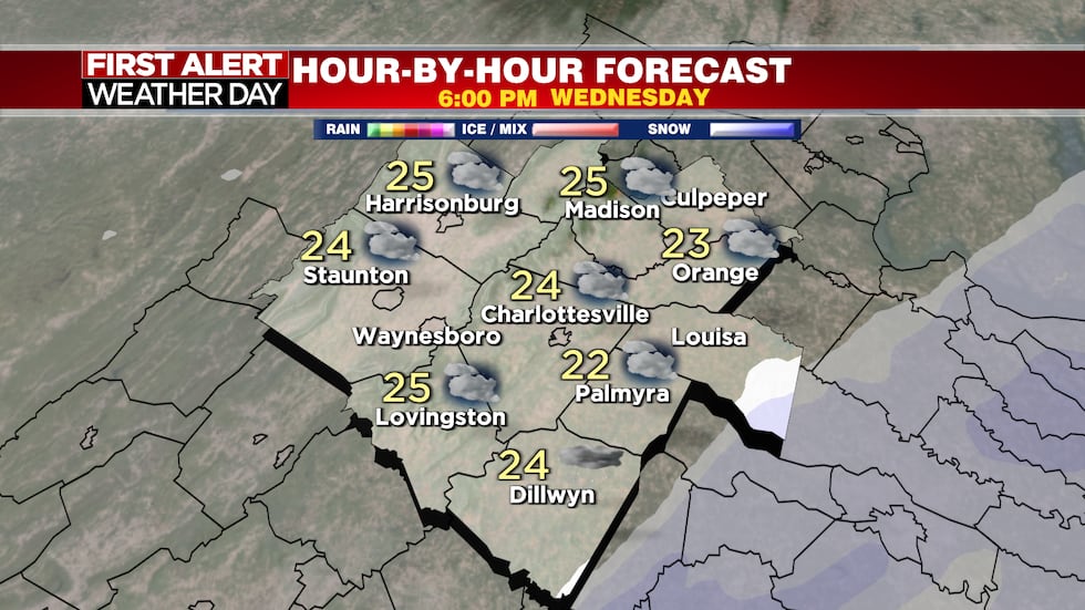
Steady snow exits by late afternoon and overnight.(WVIR 29 First Alert Weather)

Just some lingering flurries and a snow shower around this evening and overnight.
The next batch of snow will arrive by pre-dawn Thursday and will last through most of the morning. This will cause an additional light snow accumulation and slick travel.
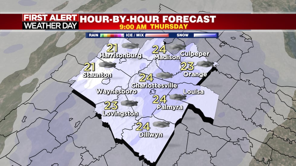
New snow Thursday morning.(WVIR 29 First Alert Weather)
Total snowfall from Wednesday morning through Thursday morning will range from one to four inches for much of the region.

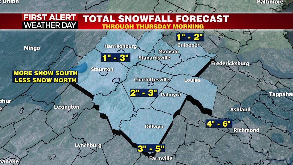
One to four inches of snow across the region by noon Thursday. Less snow north and more snow south.(WVIR 29 First Alert Weather)
Lower snow amounts north and higher totals south. Hampton Roads and Virginia Beach will receive the most snow from these weather systems.
Here’s the bottom line.
Key points to this latest winter weather event.(WVIR 29 First Alert Weather)

New snow arrives Thursday morning with some more accumulation. It’s a dry, powdery snow with temperatures well below freezing. It’s enough snow for slick areas and school closings again Thursday. Perhaps more school delays and closings for Friday.
It’s important you keep checking back here, to 29News and the 29 First Alert Weather app for updates.
Temperatures stay at or below freezing until Friday afternoon.
A milder weather outlook as we head into the last week of February.

A quieter and milder weather outlook for a time next week.(WVIR 29 First Alert Weather)
Do you have a story idea? Send us your news tip here.
Copyright 2025 WVIR. All rights reserved.
