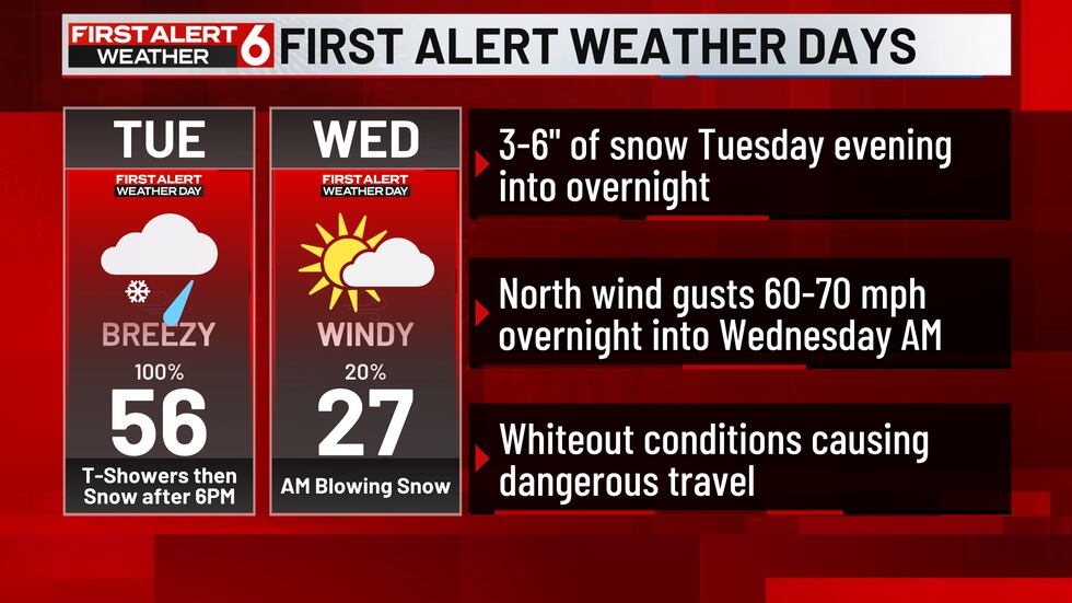
OMAHA, Neb. (WOWT) – Tuesday & Wednesday are First Alert 6 Weather Days due to the rapidly changing weather conditions that will eventually lead to a blizzard later tonight.
First Alert 6 Days(First Alert 6)
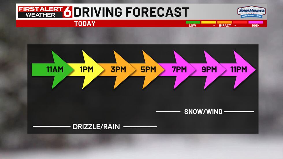
Tuesday starts with mist and drizzle that will be intermittent through the morning hours. Rain and some storms will fill in this afternoon with widespread soaking rains expected. 1/2″ to 1″ totals are possible before we see the rain change to snow near or just after 6pm.

6pm Tuesday(First Alert 6)

That changeover will happen west to east from 6pm to 9pm and once it changes the snow is likely to be very heavy. Snowfall rates up to 1.5″ per hour are possible at times during this brief round of snow that should wrap up by 3am for most of us. We should be able to stack it up rather quickly at times resulting in a widespread 3″-6″ of snow for a large portion of the area.
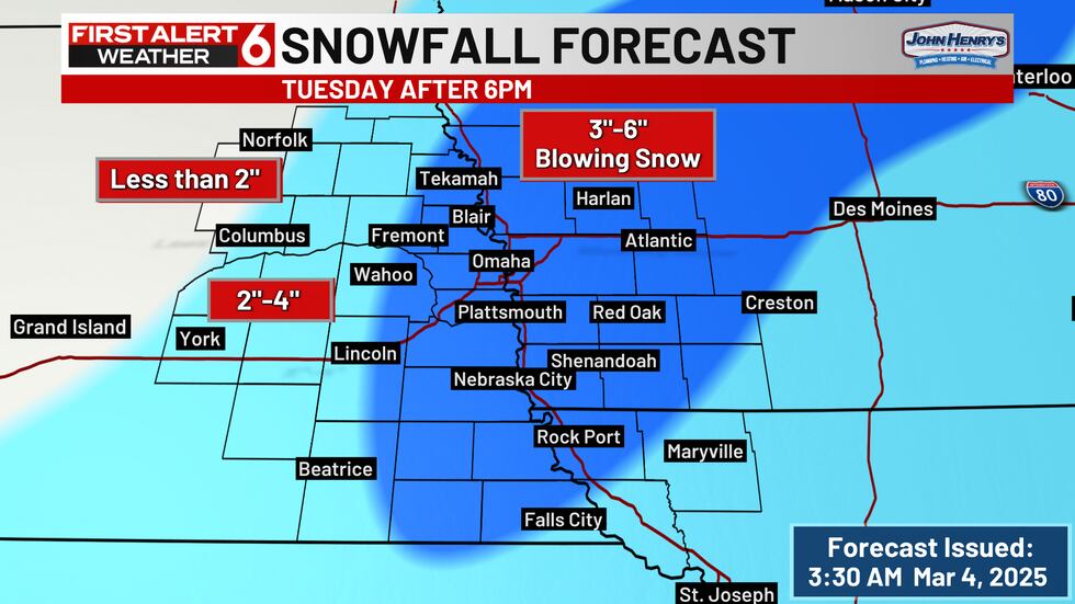
Snow Forecast(First Alert 6)

Winter Storm Alerts(First Alert 6)
A few hours before you get your changeover to snow, the north wind is expected to increase quickly and gust in the 60-70 mph range. This will cause whiteout conditions combined with falling snow and will make travel difficult if not impossible across much of the area during the window of snow from 6pm to 3am. This could also cause damage and lead to power outages.


Wind Gusts Tuesday(First Alert 6)
Driving Forecast(First Alert 6)
That wind will persist all night long after the snow is done falling but blowing snow will be an issue well into the morning hours Wednesday. Roads will gradually improve during the day Wednesday as the sun emerges but the winds will be slow to back off.
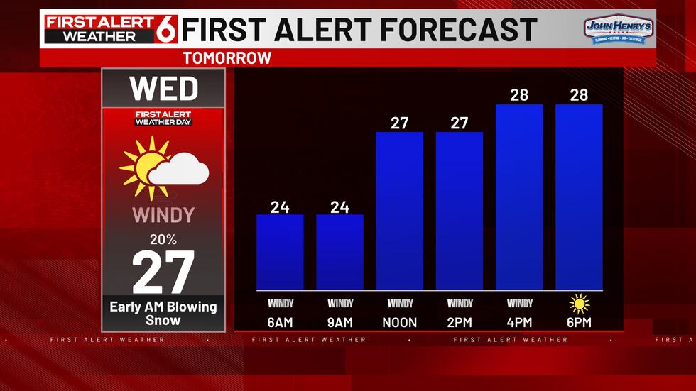
Wednesday Forecast(First Alert 6)


Wind Gusts Wed(First Alert 6)
Thursday will be rather quiet but with increasing clouds expected. Later on Thursday night there is potential for another round of light rain changing to snow that would linger into Friday morning too. We’ll have more on that round after we get through this round of snow.
Copyright 2025 WOWT. All rights reserved.
